The Old Forced Road

This plaque was added to the Historical Plaque Program in 2022, in partnership with the Russell and District Historical Society.
This plaque is located at the Recreation Trail entrance, near 331 Forced Road, Russell.
Lots and Concessions are Marked
The American Revolution and the arrival of the United Empire Loyalists led to the Constitutional Act of 1791, which separated the Province of Quebec into Upper Canada and Lower Canada.
Upper Canada was surveyed in the British system; township boundaries were 10 miles by 10 miles square. Each township was laid out in concessions (from west to east) and lots (from south to north).
Surveyor’s chains were exactly 66 feet long. A 66-foot road allowance running approximately north-south was located between the concessions. A similar road allowance running east-west was located between every five lots.
By 1822, the survey was completed in the Township of Russell to mark out the plots for the new settlers. The lots were laid out in 200 acres.
To help the Loyalists, the head of every household was granted a lot of 200 acres. Every son when he became of age, and every daughter upon marriage, received the same land grant.
The earliest map of our Township showing lots and concessions dates from 1825. It noted the first owners, but no roads.
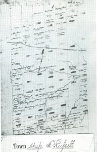
The black smudges on lots were clergy reserves. As land petitions were granted, the names of landowners were written on the lots. Not all the original lot owners settled here.
The Canada Company, a large private chartered British land development company, was incorporated in 1826 to help colonize a large part of Upper Canada. It was originally formed to acquire and develop the undeveloped clergy reserves and crown reserves. In 1827, the Company acquired these undeveloped clergy reserves and crown reserves for $693,000 from the Province of Upper Canada. The Canada Company became the largest landowner in our Township.
The Canada Company’s land surveyor, Duncan McDonnell, reported that there was only one settler in the region; a Mr. Elisha Loucks, who had established a small farm and a sawmill on the “Castere River”. McDonnell described the land as consisting of large swamps with white sandy bottoms. He also indicated that there were no roads.
A Road is Mapped
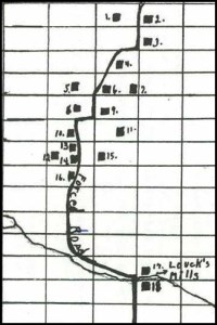
The surveyor’s 1841 assessment map was the first map to display a road. This map also listed the names of the first landowners, even though not all the original lot owners ever settled here.
Wendell Stanley wrote on this map the location of a Forced Road as it passed through Russell Township.
“Forced Roads”
While the surveyors map shows neat straight lines laying out the Lots and Concessions, there was uneven ground and swamps that made it difficult to build roads. The roads were often diverted away from the road allowances to find easier ground or to run along side rivers. These were called “forced roads”. While they were legitimate township roads, they often cut across lot lines to find the easiest path to get around obstacles in a public road allowance, such as a rock outcrop, a steep hill or a swamp.
Although this was trespassing, the owners of the land were usually grateful for the access, and often did not seek compensation. When there was protest, local authorities typically did not bother to follow-up with the expensive busy-work of surveying, purchasing, or expropriating the trespassed land. It remained a "forced road" until the local road authority finalized their legal title to the land.
The old Forced Road was thought to follow a trail used by First Nation people for hunting, fishing and collecting natural products like butternuts, and medicinal plants. The north-south trail extended from the Ottawa River (near present day Cumberland) to the St Lawrence River (near present day Morrisburg).
Settlers on Forced Road
The family of Elisha Fox Loucks (formerly spelled Loux) and Elizabeth Rupert were the first settlers in Russell Township.
Learn more about the Loucks Family and the Loucks Cemetery.
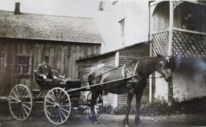
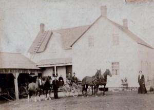
By the late 1820's, almost all of the reasonably fertile land in Carleton County had been taken. This meant that the settlers had to farm on poor soil and forced them to migrate to new areas such as Russell County.
Many of the first settlers saw the opportunity to lumber our forests. In 1832, there were only 5 families in Russell Township. By 1842 the population was 196.
Our Township became an area of secondary settlement for a number of Carleton County families including the Argues, Booths, Bolands and Borlands, Cherrys, Craigs, Harris, Morrows and Youngs.
In 1850 Robert and Sarah (Lawlor) Young settled along the old Forced Road and John and Mary (McGuire) Borland settled next to them. The descendants of both pioneer families still own property and live along the Forced Road.
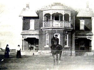
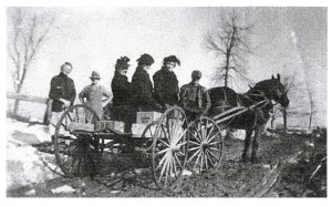
John Moffat purchased the Robert Young farm (at the end of the present Forced Road) in 1902 and his descendants farmed the land until 2000.
Thomas C. Young built the brick farm house “La Grange” in 1904.
In 1857, Henry and his father William Fitzpatrick purchased the west half of Lot 12, Concession 2 and the farm (on the present Forced Road near Craig Street) stayed in their family until 1929.
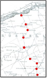
By 1879 stagecoaches were operating along the old Forced Road and post offices were located at each of the stop off places along the way.
Forced Road Today
Today, two portions of the old Forced Road in the Township of Russell and Cumberland Township are still called “Forced Road”. Old time residents refer to it as “the Forced Road”. The Township of Russell portion in the Village of Russell extends north of Craig Street to Route 200 and the Cumberland portion winds its way from Vars to Bearbrook.
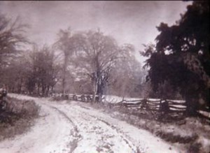
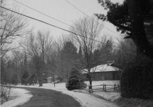
The historic tree-lined Forced Road in Russell has been a favourite route for tourists and residents in every season of the year.
 References
Contributions to this article were received from: Roger Young, Su Young, Marjorie Moffat, Mary Boland, Donald McCaffrey, Bill Rombough, and Gerry Boyer.
Boyer, G.C. 2017. Map of Cumberland Township tracing the Old Forced Road.
Heritage Quest. 2004. Archaeological Resource Inventory and Assessment of Potential Russell Township, Prescott-Russell County, Appendix 11 of the Township of Russell Official Plan.
H. Belden & Co. 1867, 1879, 1881. Historical Atlas of Prescott & Russell, Stormont, Dundas, Glengarry Counties, Ontario.
MTBA Associates. 2019. Village of Russell Heritage Conservation District Study.
Stanley, W.M. 1987. From Swamp and Shanty – the history of Russell Village and the western part of Russell Township 1827-1987. Runge Press Ltd, Ottawa, Ontario.
